Areas of cover
1. The Netherlands - standard
The Netherlands with the exception of the coastal waters, the Wadden Sea, the Dollart, the Ems, the Eastern Scheldt, the Western Scheldt, the IJsselmeer and the Markermeer, but including the IJmeer;
2. The Netherlands - expanded
The Netherlands including a zone of 12 nautical miles off the coast, the Wadden Sea, the Dollart, the Ems, the IJsselmeer, the Markermeer, the Eastern Scheldt and the Western Scheldt;
3. Europe
The geographical area of the countries of continental Europe, including a zone of 12 nautical miles off the coast up to 65° north latitude;
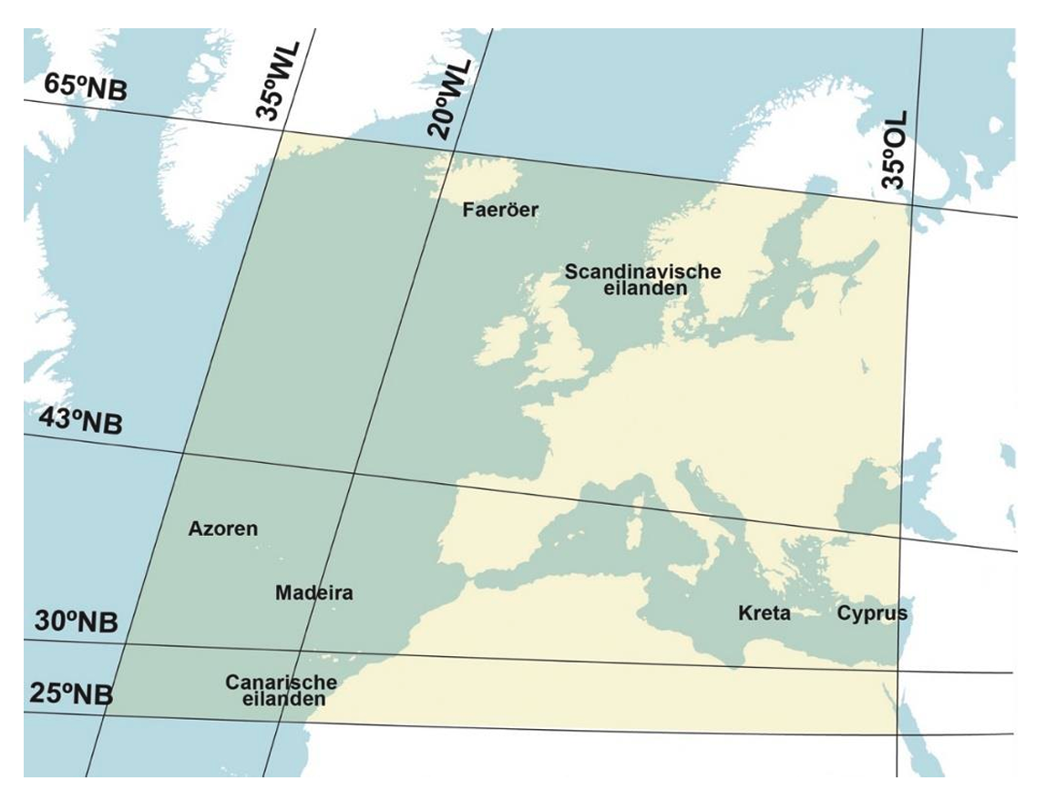
4. Small quadrangle
Europe within the quadrangle of 65° north latitude to 43° north latitude and 20° west longitude to 35° east longitude;
5. Europe and the Mediterranean
The geographical area of the countries of continental Europe, including the Mediterranean with adjacent waters but with the exception of the Black Sea, within the limits of 35° east longitude and 20 nautical miles off the North-African coast. The Strait of Gibraltar is within the cruising limits;
6. Large quadrangle
Europe within the quadrangle of 65° north latitude to 30° north latitude and 20° west longitude to 35° east longitude;
7. Extra large quadrangle
Europe within the quadrangle of 65° north latitude to 25° north latitude and 35° west longitude to 35° east longitude.